
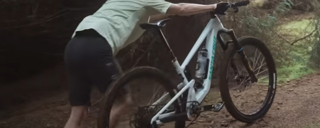
Are you looking to take your rides to the next level? Or maybe you're just getting started and need some extra motivation and guidance toward hitting your personal goals? With the rise of technology, the best cycling apps can help you track your progress, plan your routes, and connect you with other riders.
- Best mountain bikes you can buy for under £2,000
- Best MTB's that you can get shipped straight to your door
- How to go bikepacking: A beginner's guide to getting started
We understand that with the growing number of options out there, deciding which app to download and use can be a confusing and frustrating experience - which is where we come in. In this guide, we will dive into some of the most innovative and user-friendly cycling apps on the market. From virtual coaching to social networking, the apps listed below will assist in enhancing your riding experience.
The smartphone is an incredibly powerful tool that can help you out in myriad ways while riding. We understand that not everyone is looking to smash KOMs but rather explore routes and enjoy the scenery along the way. Some of the best cycling apps will even ensure you leave the house best prepared in the appropriate riding apparel to combat the predicted weather forecast. If you are looking to build up the confidence to venture out alone, these apps can give you tips for those unexpected first aid emergencies and allow your rides to be GPS tracked in real-time for safety by a next of kin even when you are escaping by bike into the backcountry wilderness.
This buyer guide highlights a selection of the best iPhone and Android apps for mountain biking. Keep reading to learn more or skip to the bottom for answers to the most frequently asked questions about what to look for when buying one of the best cycling apps.
- Outdooractive
- What3words
- Dark Sky Weather
- Strava
- First Aid by British Red Cross
- Komoot
- Bike Computer
- MapMyRide
- Mywindsock
- Bike Gear Calculator
- TrailForks
- Ride with GPS
- Bicycle Maintenance Guide
- MTB Hangtime
Outdooractive

Price: Free, with in-app purchases
Format: iPhone, Android
From: Outdooractive
While Google Maps is a pretty good app for pottering about, Outdooractive (formerly known as ViewRanger) is a more useful and feature-packed mapping app. It makes easy work of route planning, exploring, and navigation for those unfamiliar rides. The free Open Cycle Map is surprisingly useful, with loads of bike-specific routes and features marked out.
It lets you download super high-detail topographic maps of the world for an annual fee of £26.99 for the Pro level subscription. That means UK riders can take full advantage of the high-quality Ordnance Survey maps. As the maps download to your phone, it ensures that you still have navigation and mapping with no signal and data coverage. The Pro level also includes the 'Skyline' augmented reality feature that overlays peaks and points of interest as you pan with the camera and a safety feature called 'Buddy Beacon' that allows you to share your location with selected friends, so they know that you're safe and an accurate location to find you in an emergency.
It's possible to record, follow and create routes in the app or on a computer, as well as being able to add points of interest. The Pro Plus subscription for £53.99/year gets you ADFC cycling maps for Europe, curated premium routes, and weather features.
What3words

Price: Free
Format: Apple iOS/Android Google Play
From: What3words
What3words is a geolocating app that uses a three-word code to locate you anywhere on Earth. While it's good for trying to make sure that parcels get delivered to your house, it's also gaining rapid acceptance by police, ambulance and mountain rescue teams as a simple way to get help to people that need it.
The free downloadable app works by splitting the planet into three-metre by three-metre squares, which are then given a unique three-word code. That gives a rapid, simple and relatively foolproof way of sharing any location, which is coming in very handy for emergency services teams.
Dark Sky Weather

Price: Free / Premium Club is £5.99 a year
Format: Apple iOS/Android Google Play/Online
From: Dark Sky
Being caught in unpredictable weather conditions can be a frustrating, even dangerous experience. The Dark Sky app is an essential tool that provides detailed weather forecasting, giving cyclists the ability to plan their rides with more accuracy. The app offers multi-day weather predictions that allow you to know what the weather will be like in advance, enabling you to dress appropriately and avoid any unpleasant surprises while on your ride.
The app also features weather radar, which allows you to track any incoming weather systems that could potentially impact your ride. With this information, you can avoid getting caught in heavy rain or strong winds, which can make for a dangerous and unpleasant cycling experience. Additionally, the temperature maps feature enables you to plan your route better and avoid areas that may be too hot or too cold for you.
The custom alerts feature is a particularly useful tool that sets the app apart from other weather forecasting tools. The app allows you to set alerts for specific weather conditions, such as rainfall, wind, or temperature drops, ensuring you are well prepared for any changes that may occur during your ride. This feature can also help you avoid getting caught out in dangerous weather conditions, such as a sudden thunderstorm or freezing temperatures.
The Dark Sky app's user-friendly interface makes it easy to navigate, and the information is presented in a clear and concise manner. The app is compatible with both iOS and Android devices and offers a range of customisation options, such as changing the temperature units or selecting different locations.
Strava

Price: Free or £8.99 a month (or £54.99 annually) for Premium
Format: Apple iOS/Android Google Play/Online
From: Strava
When it comes to apps for cycling there are few that draw such strong opinions as Strava. Loved by many for the way it records rides and training, it's hated by an equal number who hold it to blame for corner-cutting trail destruction and all manner of riding rudeness as users attempt to become King or Queen of the Mountain. We're not going to get sucked into those arguments here, but we do think it's worth giving a go even if you don't care about being fastest up, down or along anything.
A really cool feature of Strava is the fact that you can use it to find new trails near you by using 'Segment Explore'. That'll show you any riding segments in a specific area and it's great for showing you whether that bit of woodland you're wondering about is bereft of any trails or is, in fact, a secret warren of singletrack delights.
If you want to see overall segment leaderboards, and your personal results and want to discover new routes, you'll need to cough up for the subscription, which unlocks a whole host of other neat things, with loads more analysis of your training possible. It also gives you the 'Buddy Beacon', which allows you to let up to three people track you in real-time as you're riding, so they know whether you're okay or not. Premium also allows you to see how you're doing on a segment in real-time, though we'd suggest you keep that for the climbs rather than the technical descents.
First Aid by British Red Cross

Price: Free
Format: Apple iOS/Android Google Play/Online
From: British Red Cross
The app is a comprehensive first-aid guide that walks you through how to respond to various situations that you may encounter while cycling. From cuts and scrapes to broken bones, the app provides clear and concise instructions on what to do in these situations. The app also includes videos and animations to help guide you through the steps, making it easier to understand and follow.
One of the unique features of the app is its built-in checklists. These checklists are designed to help you prepare for various scenarios that you may encounter while cycling, such as heatwaves or even terrorist attacks.
While no one wants to think about the possibility of getting injured while cycling, having this app on hand can be invaluable. It provides a level of comfort and reassurance, knowing that you have the knowledge and tools necessary to respond to any situation that may arise. So, whether you're a beginner or an experienced rider, consider downloading this app and taking the time to familiarise yourself with its content. It may just prove to be a lifesaver in the event of an emergency.
Komoot

Price: Free or one-off payments of £3.99 for a Single Region map, £8.99 for a Region Bundle or top level World map pack is £29.99
Format: Apple iOS/Android Google Play/Online
From: Komoot
The Komoot app is a true game-changer for off-road cyclists, offering advanced mapping and routing features that can help you take your rides to the next level. With its voice command feature, Komoot turns your smartphone into a proper sat nav, allowing you to navigate rides with ease. Simply set your location, the type of bike or trail you want to use and where you want to get to before your ride, and Komoot will save it as a planned journey. It then records your activities as 'completed tours', so you can keep track of your progress and accomplishments.
One of the unique features of Komoot is its routes. Unlike other navigation apps, Komoot often gives you numerous options for reaching your destination, some of which may not be the quickest but are more scenic and adventurous. This makes it an excellent app choice for off-road cyclists who want to explore new trails and terrain.
The Komoot app is an essential tool for any off-road cyclist looking to explore new trails, push their limits, and take their rides to the next level. With its user-friendly interface and advanced features, you can plan and navigate your rides with ease, and discover new routes and hidden gems along the way.
Bike Computer

Price: Free
Format: Apple iOS/Android Google Play
From: Bike Computer Co.
The Bike Computer app is a simple programme that replaces the need for an expensive computer when you already have the capability within your smartphone device. The app will track your rides, monitor performance, and analyse data. This mobile application allows you to accurately track your speed, distance, elevation, and other key metrics while you ride.
Using your phone's GPS, the app provides you with real-time data during your ride and detailed route maps after your ride. This information is invaluable for off-road riders looking to analyze their performance on specific sections of a trail or compare different rides to see where they can improve.
The key benefit of the Bike Computer app is its flexibility and customisation. You can choose which data fields to display on your screen, such as speed, distance, time, and cadence, and set up alerts to notify you when you reach specific milestones or goals. All this is free to download and use. The customisation is particularly useful for riders who want to monitor their performance on technical sections of a trail or set personal best times on challenging climbs.
MapMyRide

Price: Free / £5.99 a month or £29.99 a year for MapMyRide+
Format: Apple iOS/Android Google Play/Online
From: MapMy Ride
MapMyRide was developed by the brand Under Armour. This free app is available for both iOS and Android and can be downloaded from their respective app stores.
The app offers basic features such as tracking your ride, recording your route and providing basic analytics. There is also a premium version called MapMyRide+ which offers advanced features such as training plans, audio coaching and live tracking. MapMyRide+ costs £5.99 per month or £29.99 per year, and you can subscribe directly from within the app.
Once you've downloaded the app, you'll be prompted to create a profile, which includes your name, age, and gender. You can also connect your social media accounts, including Facebook and Twitter, which allows you to share your rides with your friends and followers.
One of the key features of MapMyRide is its mapping functionality. You can use the app to plan and record your routes, and it will also provide you with turn-by-turn directions to help you navigate your way. Another useful feature of MapMyRide is its ability to track your ride metrics, including distance, speed, and elevation gain. You can set goals for your rides and monitor your progress over time, which can be motivating if you're trying to improve your fitness or beat a personal best.
MyWindsock

Price: Free or Premium £19.99 per year subscription
Format: Online
From: MyWindsock.com
MyWindsock.com is an online platform that offers a unique combination of current and historical weather data with ride data from some of the best cycling apps, such as Komoot, Ride with GPS and Strava. This can be valuable for riders who admit to taking their segment ranking seriously and those among us (we all know who they are) that have an eye on the finer details and data analysis.
MyWindsock.com combines current and historical weather data with Strava segments so you can find out if the rider that snatched your segment KOM crown had a helpful push from a tailwind, or if they are plainly just that much more rapid than you. Mywindsock.com can simulate your next ride to help you make tactical and strategic decisions of when to push and when to conserve, optimising your ride performance by plotting when you might face a headwind
MyWindsock uses weather data from multiple sources. This data is adjusted for factors that will affect your route, such as buildings, trees, and topography providing information about wind, its speed, and direction. The data is clearly displayed visually in a graphic format using a colour code like red, purple, and light blue, representing headwinds, crosswinds, and tailwinds, respectively.
Bike Gear Calculator

Price: Free or Premium for £2.99 a month
Format: Apple iOS only
From: Apple Store
The Bike Gear Calculator provides a convenient way to compare different gears on your bike by taking out any guesswork and pondering potential setups you're considering during a new bike build or just a drivetrain refresh. It also allows you to see an estimated speed at a particular cadence for each gear.
With the Bike Gear Calculator, all you need to do is input your bike details and the calculator takes care of the rest for you saving you time, guesswork and potentially a costly mistake.
This app can help you work out the best setup for your bike. The app tells you how fast you’ll be going in a chosen gear at any cadence you choose, and you might use this information to inform your riding technique or plan how to attack your next timed segment. But it might help explain that you are over-geared, and that's the reason why you are struggling to get up a particular climb on a regular route. It will show what the difference will be between swapping the ratio on your cassette or changing to another chainring.
If you’re a time trialist or you take your Strava KOMs very seriously, you could even use the app to help plan your next assault. Simply set your average speed and your preferred cadence, and the Bike Gear Calculator app will give you the drivetrain set up you need for a given course.
A free version of the Bike Gear Calculator is available for Apple devices and for just £2.99, you can upgrade to the more advanced edition.
TrailForks

Price: Free or Trailforks PRO (with O+ and Gaia GPS) is £2.32 a month
Format: Apple iOS/Android Google Play/Online
From: Trailforks
Trailforks is an online platform and mobile application that provides trail maps and route information from user-generated content. It will give users route details for both mountain bikes and hiking trails around the world. It was created by the online community of Pinkbike.
The Trailforks platform boasts 4 million users and allows riders to discover new trails, explore maps, view photos and videos of trails, as well as user-generated information on access trail conditions and ratings. Users can also contribute to the platform by adding new trails, submitting reviews and ratings, and sharing photos and videos.
In addition to the web platform, Trailforks also offers a mobile application that allows users to track their rides and experiences as well as access trail information and maps on the go. The mobile app also includes features such as offline map access and ride tracking. One bonus feature is the ability to download trail maps for use when there is no internet connection available.
Ride with GPS

Price: Free / Basic $7.99 a month / Premium $9.99
Format: Apple iOS/Android Google Play/Online
From: ridewithgps.com
Like other ride-tracking apps, Ride with GPS is an online platform and mobile application that allows cyclists and other outdoor enthusiasts to plan, track, and share their rides. Whether you're a seasoned pro or a beginner looking for a new adventure, Ride with GPS can help you get the most out of your cycling experiences.
It comes in three tiers of subscription, from the free offering to the basic ($7.99 a month) up to the premium level ($9.99 a month). Their tier systems offer an entry that caters for every rider's wallet. The free version of the app gives riders the ability to create and record their rides with the iOS or Android app. The Basic subscription gives riders turn-by-turn navigation and mobile route planning. This level of subscription also allows for access to the RidewithGPS heat map and offers multiple privacy zones. The top Premium tier gives you advanced route planning, custom cues and points of interest alongside the option to make private segments in your routes.
It is undoubted that Strava is a more popular social ride-sharing app. But if you are looking for a more robust and advanced route planning and navigation app that features turn-by-turn navigation, RidewithGPS is a better-suited smartphone app option.
Bicycle Maintenance Guide

Price: £3.99
Format: Apple iOS/Android Google Play/Online
From: Bicycle Maintenance Guide
The Bicycle Maintenance Guide app has everything you need and more to maintain and repair your bike whether you ride a road bike, MTBs, gravel and e-MTBs are all covered. The Bicycle Maintenance Guide app is a complete guide to bicycle repairs, shown and instructed by the Head Bike Mechanic of a UK professional cycling team Chuck Buckley and former Team GB mechanic, Mike Rawson.
This app is made up of 60 videos containing over 7.5 hours of footage, 180+ images, over 130 sections and 50,000 words. What this app offers you for the fee and also where it differs from others options, including the usual YouTube video, is that all their guides are available offline with no internet connectivity. This means that even if you are stuck with broken bike miles from home with no signal, this app could provide you with a fix to get you home.
The app provides an easy way to navigate to a specific fault or repair on your bicycle. The professionally filmed and edited videos are made by current professional bicycle mechanics ensuring the material is accurate, up to date and with a high level of detail.
For the price of a mid-ride coffee, you could have a comprehensive bike repair guide with you in your pocket whenever you might need it.
MTB Hangtime

Price: Free / Pro £0.99 a month / Premium £1.99 a month
Format: Apple iOS and Android Google Play Store
From: Google Play and Apple App Store
The MTB Hangtime app uses your phone's accelerometer to tell you what's going on during your mountain bike ride. This fun app can measure the key specific metrics during your trail ride, from total time in the air, how high you've vertically jumped, your speed across the ground, as well as the lean angle of your bike in either axis.
The app allows riders to overlay their data on a 3D map of their ride. By using the phone's built-in accelerometer and gyroscope, the app will also give you details like the maximum G force achieved whilst braking and cornering. Your ride is then given an overall score rating for the detail of your ride pitched against fellow app users in a leaderboard.
Available for both Apple and Android phones for free, giving riders fifteen different eight-hour-long activity or ride recordings. The Pro subscription unlocks double the amount of recordings for less than a pound and you can get unlimited activity recordings for £1.99 a month premium subscription.
You will have to mount your smartphone to your bike as it will not work with vibrations inside your pocket or ride pack.
How to choose the best cycling apps
Choosing from the best cycling apps to determine which are the most relevant for your riding can be a daunting prospect owing to the many options available. To select the right one, you should consider what purpose of your riding. You will want to consider what features the programme offers and how easy it is to use. You will need to check that the app is compatible with your smartphone and consider the costs associated to gain all the features you might want to use.
A simple way to find your pick is to identify your goals and choose an app that aligns best with what you decide. Hunting through the app's features to find the ones you need, from GPS ride tracking, route planning and turn-by-turn navigation to training tools and virtual coaching.
What are your goals?
Using the best cycling apps can be a great tool to help you hit your riding goals. To get the most out of it, you can start by figuring out what you are looking to achieve to maximise how the apps could best serve you and your riding. By setting specific goals for your rides and using apps that feature ride tracking to monitor your progress. Joining challenges, getting feedback on your performance from followers and friends, and planning your rides in advance can also help keep you motivated and on track.
If you enjoy the peace of riding on your own, you might find everything needed to explore and plan new routes by utilising apps such as Komoot, Strava and Ride with GPS, from everything type of ride covered from epic adventures to fine-tuning or spicing up your office commute. Additionally, many of the best cycling apps have features that allow you to discover new routes, which can keep your rides fresh and interesting, especially useful if you are getting bored of your local spots and route and if you are more adventurous.
Finally, sharing your progress with friends or on social media can help you stay accountable and motivated to strive for improvements and, of course, snatch those all-important segment wins. By using apps in these ways, you can make the most of your rides and reach your goals faster.
What type of riding do you enjoy?
The type of riding you enjoy and where you intend to ride can have a significant impact on the cycling apps that are best suited to you. For example, if you're a roadie, apps that provide route planning and navigation, such as Strava and Komoot, or apps that focus on data analysis, like mywindsock may be the more suited to you. Downloading MTB Hangtime will be pretty pointless if you never intend to get a little wind under your wheels.
If you're an off-road rider, apps that offer trail maps and GPS tracking, such as Trailforks and Komoot, may be better suited to your needs. A commuter rider might need apps that provide real-time traffic updates and bike-friendly routes safely away from traffic, such as Google Maps and Citymapper. Additionally, if you're interested in tracking your performance and progress, apps like Strava and MapMyRide are great for monitoring speed, distance, and other metrics. Ultimately, choosing from the best cycling apps depends on your personal needs and preferences, as well as the type of cycling you enjoy.
Are you using the app to track fitness, navigate or for safety?
The best cycling apps can be very versatile, providing features that cater to tracking fitness, navigating, and increasing safety while on a ride. To make the most out of these apps, you should explore some of the apps we suggest in this guide and then familiarise yourself with their different features and choose the ones that best serve your riding needs.
For tracking fitness, the app can help monitor your progress, set goals, create custom workouts, and follow pre-made training plans. For navigating, many cycling apps offer turn-by-turn navigation, real-time traffic updates, and the ability to create custom routes, but these mostly require a subscription.
Finally, for safety, some apps offer accident detection, location tracking, "Find My Friends" features, and "beacon" features. Some smartphone apps provide riders with a helpful first-aid guide for trailside emergencies like treating cuts and how to make a tourniquet.
Can I use my smartphone instead of a cycling computer?
Yes, you can use your smartphone instead of one of the best cycling computers. Many cycling apps such as Bike Computer are designed specifically for smartphones, offering a range of features comparable to those found on traditional cycling computers.
Using your smartphone for cycling has several advantages. For one, it's convenient and makes perfect sense as most riders will carry their smartphones. In addition, the best cycling apps are often free or inexpensive, resulting in a cost-effective alternative to buying an additional expensive cycling computer.
When using your smartphone for riding, you'll want to ensure you have the best mount or case you can afford to secure and protect it from the elements while on the bike. In addition, if you intend to head off on longer rides or you intend to head out on multi-day epics, ensure you have a reliable battery backup plan, as using the GPS and having a large screen running hour after hour alongside other features of the app will drain your phone's battery quicker than you might think.
Another crucial consideration is that you can never 100% rely on the internet and mobile phone signal. Hence, we suggest you always carry familiar additional means of navigation, such as a compass and a map of the area you intend to ride in. In addition, it would be wise always to tell someone where you are heading and when you can be expected back.

Comments
Found some useful new apps on
Found some useful new apps on here - great stuff!
I'd add a slight note of
I'd add a slight note of caution about the Viewranger service and the GPX files it produces and alternative recommendations for GPS navigation.
When I saw the Viewranger app and the web service last summer I got all excited. The best maps for the UK outdoors activities (OS 1:25000), Openstreet Map for towns, a decent app you could plan with and, unlike OS, full autorouting on the OS maps across the whole of the UK. What's not to like?
The problem is/was Viewranger's autorouting algorithm. Specifically, it puts very few waypoints on the tracks that it is following. Consequently, the straight lines marking the route between these waypoints only corresponds roughly to the actual tracks on the basemap. As you could reference the basemap, this was fine for planning and was fine if you had the app open on your smart device when out riding.
However, the problems came if you tried to use the GPX files on a standalone GPS device without reference to that basemap, such as a Garmin. In the field, the paucity of waypoints meant the route that the Garmin would attempt to lead you on was frequently on the wrong side of hedges, ditches, roads and was, as might be imagined, next to useless where there was a decision about multiple track options. You either ended up flattening your phone's batteries because you had to keep the app open. Or putting up with going off in the wrong direction and having to retrace your steps. I ended up giving up on it.
fwiw, I think the Ordnance Survey maps app and premium service are good value https://www.ordnancesurvey.co.uk/shop/os-maps-mobile.html. The apps have offline maps capability for planned routes and the patchy autorouting capabilities are not a problem if you're doing short rides or are riding in a national park. For longer days (I've done out to 120km gravel/all-road routes), then I've not found anything better than the combination of the rather excellent RideWithGPS to generate the GPX files and the OS maps service and app for reference during the planning and for offline maps when out riding (should I need them).
shufflingb wrote:
That's really interesting - I'll have to try that combination out. I've not tried Viewranger > Garmin yet, so not experienced that issue...
I think there's a bit of
I think there's a bit of confusion in the first paragraph. Open Cycle Map is nothing to do with Ordnance Survey. Ordnance Survey (OS) is a business which produces very accurate (but not definitive) maps of the country. They are very well respected but tend to be very protective of their data. Open Cycle Map is an extension of Open Street Map (OSM), a community based national map. OSM data is open source and they encourage sharing and individual contribution. OSM tends to have rather good information about paths and bridleways (but also not definitive). The map shows the actual location of paths and tracks rather than the definitive path which due to historical land and boundary changes may be different.
Google maps (online, haven't used the app) is great for looking up businesses nearby and on-road work but has very little information about off-road paths and tracks so I would say not at all useful for pootling around.
Like shufflingb I totally rate RideWithGPS and I'm amazed it's still not in the list. I find the combination of it and Open Street Map to be unbeatable. I plan a route on the website and save it, then I can follow it on my phone. It doesn't have voice guidance and map caching in the free version. The paid versions do but I haven't tried them.
Komoot's maps are based on
Komoot's maps are based on open source data. You get the same free on Cyclestreets (strange omission from your app selection), but you pay for them with Komoot. Despite paying for the opensource maps with Komoot, they remove useful data so for example footpaths (cycling forbidden) and bridleways (cycling permitted) are not distinguished visually. If you want that and other cycling specific stuff like national cycle routes etc, well that's a subscription on top of having already paid for the maps.